A trip to the Grand Canyon
Quick links: The Basics | Day One | Day Two | Day Three | Day Four
Back to kanaad.blogspot.com
Note: Click on the thumbnails to get full-size pictures.
The last weekend of August, Kiran and I made a trip to the Grand Canyon. Michigan, as a friend of mine likes to say, is a "topographically-challenged" state. Thus, except a Smoky Mountains trip back in 2001, I hadn't really hiked much. When Kiran called up with a "I need to get out of Houghton" sentiment and proposed taking a trip somewhere, the first destination to my mind was Grand Canyon. Alas, I hadn't bargained for what the trip would demand.
Kiran agreed with the idea in principle - and proposed an itinerary that would have us hiking from the South Rim of the canyon to the North Rim. These are 10 miles apart as the crow flies, around 23 miles to hike across and 200+ miles to go around by road.
The Basics
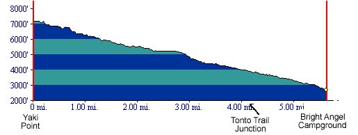 We chose to hike rim-to-rim on the Kaibab trail. The South Kaibab trail runs from the South Rim to the Bright Angel campground, a 7-8 mile hike with a descent of about 4500 ft. This is a relatively steep trail, with no water source between the south rim and the Bright Angel campground. The trail offers spectacular views of the canyon almost all the way.
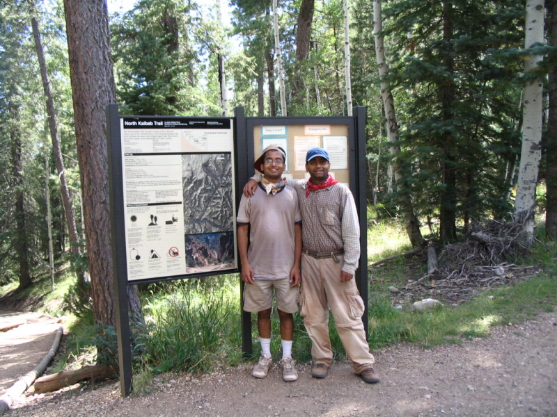
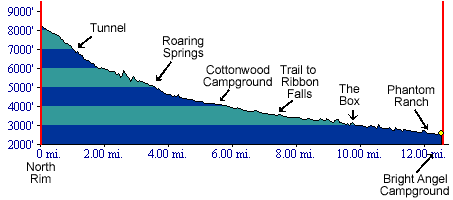 The North Kaibab trail connects to the South Kaibab at the Bright Angel campground and runs to the Cottonwood campground, a 7.4 mile stretch of slight ascent. Then, it continues all the way to the North rim, another 7.5 miles, with a 5500 ft. ascent. Unlike the South Kaibab, the North Kaibab trail does not have too many switchbacks. Rather, it mostly takes the shortest distance between two points, without regard to the gradient. It is thus a much more difficult climb than the South Kaibab. Also, because it winds around many different sections of the canyon, it does not have the wide, spectacular views that the South Kaibab has. The views on this trail are sometimes confied to just the mountain one is climbing, and near the peak, of the trail that lead to it from deep in the valley.

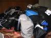
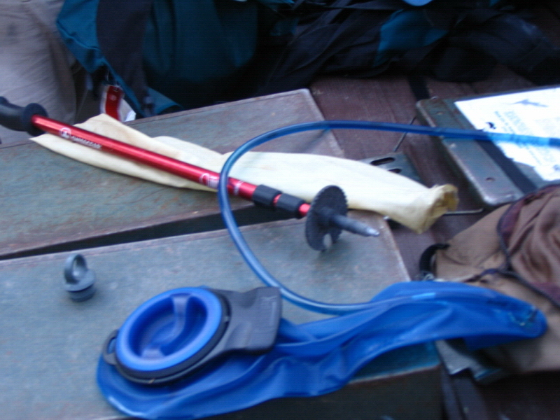
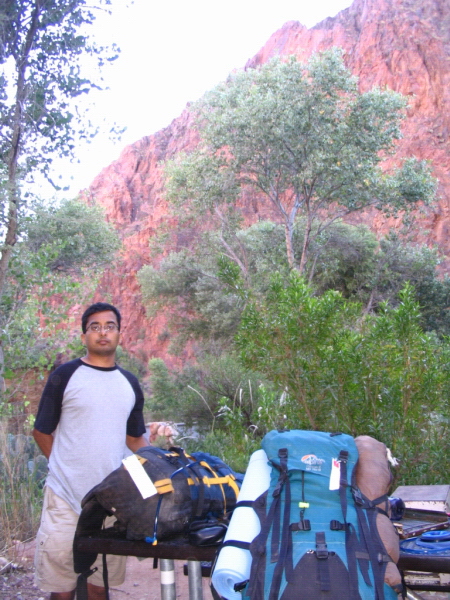
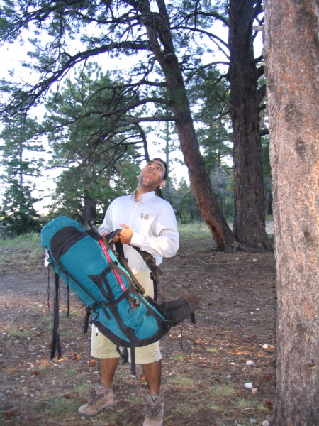
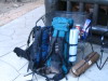 Staying at the campgrounds inside the canyon requires a reservation and a permit, normally booked at least a couple of months in advance. Kiran managed to procure it for us with a 3-week notice. We equipped ourselves with full camping gear - large backpacks, a tent, sleeping bag and pads, a trekking pole, propane cylinder and stove, water filter, and most important for hiking, a hydration pack (essentially a plastic water bag, with a pipe that runs straight to the mouth, allowing sipping on the go).
Day 1: Descending into the Canyon - South Rim to Bright Angel Campground
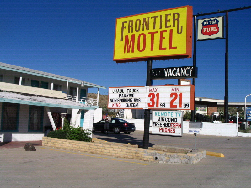
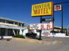 After landing in Las Vegas around 10 pm, we drove 100 miles into Arizona and made a overnight stop at Kingman. By the time I could get to bed, it was already 2 am pacific time (5 am for Ann Arbor) and sleep was the only thing on my mind. Luckily, we found a nice motel (as Kiran called it, a "po"tel - Patel Motel) just as we drove into Kingman. After a good night's sleep, we shuffled stuff from the backpacks and other luggage in a failed-effort to reduce the weight we'd have to carry on the hike.
 Another 160 miles on the road, and we were at the South Rim. There's a well-stocked grocery store inside the national park at the South Rim. We loaded up on supplies such as propane fuel, bandanas, dried lasagna etc., and readied our backpacks for the hike. We then took a bus tour of the rim. For majority of the visitors to the Grand Canyon, the trip consists of this bus ride or walking along a trail on the rim. There are several points that offer spectacular views. We visited a few of these, for our first glimpse of the canyon.
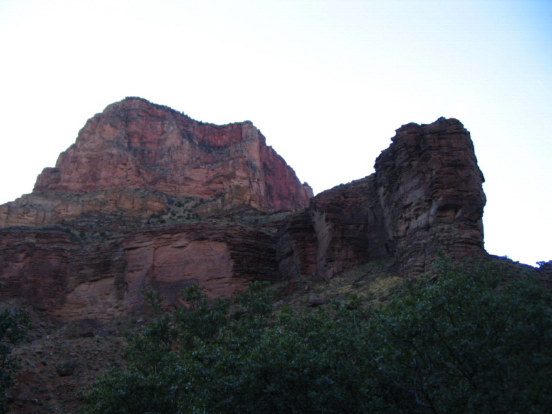
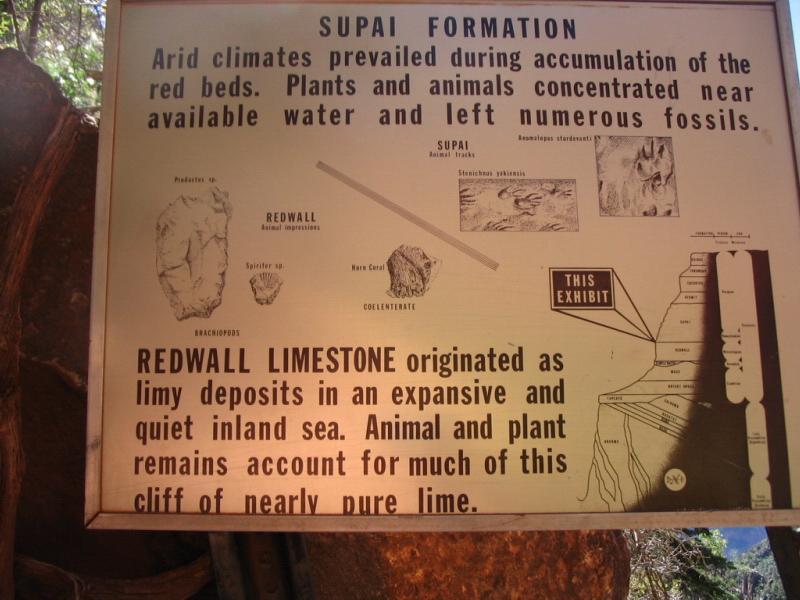
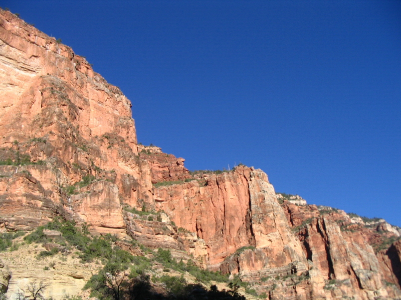
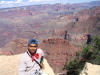
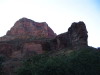
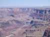
 At first sight, I was amazed at the sheer scale of the Grand Canyon. From the Hopi point on the South Rim, I could see far into the distance on either side - all I saw was the canyon. It is very deep, the river at the bottom completely unseen from the rim. The dominant colors are a light yellow near the top, of the limestone that characterizes most of the peaks and red, from the Supai rock that is a bulk of the canyon's midsection. In the distance, I could see what seemed to be the northern side of the canyon, with several peaks in between. The Grand Canyon is in reality a system of canyons, with water flow in the various valleys. The system is visually intriguing, with a cascading series of peaks of varying height visible at a distance. At mid-day, the vibrant red hues that are seen in most Grand Canyon pictures are softened by the direct sunlight, to a dark, muted shade. In fact, as I noticed during the hike, light and distance make a big difference in the Grand Canyon appears.
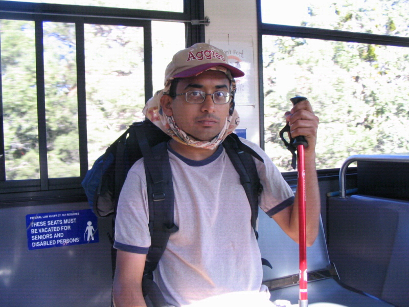
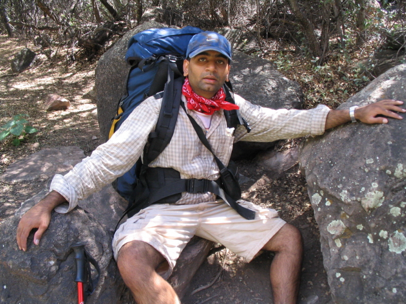
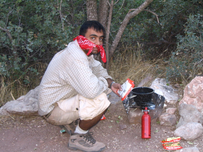
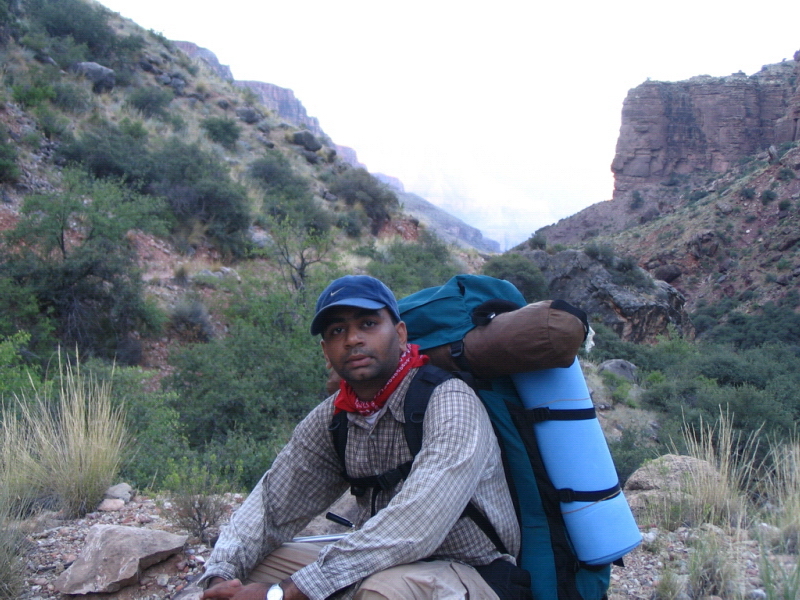
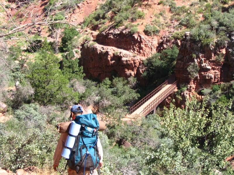
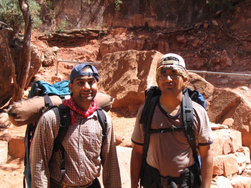
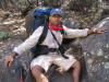
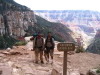
 Though mesmerized by the sight, we managed to take some good pictures. After the tour and a final round of packing, we parked the car and boarded a bus that took us to the trail head. Once there, we filled up our hydration packs, secured the various backpack straps, wetted ourselves down (in the hot months of July and August, the temperatures can get extreme, and hikers are advised to soak themselves completely to keep cool) and set off on the trail. The pictures taken at this point show a very weird-looking me, with the wet bandana wrapped around my neck, a cap, and a huge backpack. Kiran found my bandana-tying method hilarious; it did prove very effective though.
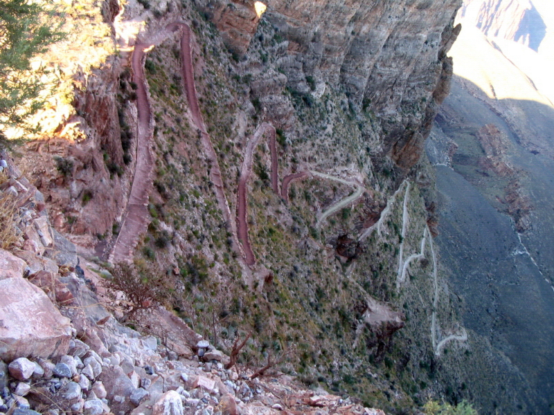
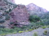
 The first stretch of the hike was a fairly steep descent, a lot of switchbacks. These are small sections that criss-cross the mountain, reduce the gradient and take the hiker down very quickly. It was already a little past 5 pm when we set off, the mountains in the distance bathed in the evening sunlight looked a very bright shade of red. The limestone quickly changed into the red supai, we left the tall trees near the top for barren red soil of the trail. We met several people hiking their way out on a steep trail that has no natural water source along the way. Others joined us on the hike down to the campground.
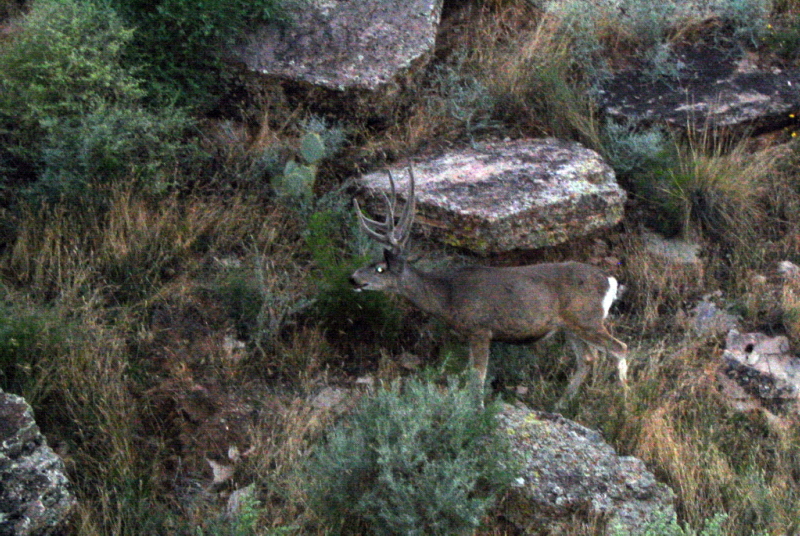
 Excited to be on our way, and amazed by the spectacular views, we took our time on the way down. Kiran paused and clicked a lot of pictures. The steep descent was good exercise for calf muscles, and severe on the knees. Before we knew it, we were past the switchbacks, the red soil had changed into a strange green-brown color, and we were inside the canyon, quite a distance from the rim. The wide, spectacular views had now changed into a wall by the side of the trail we were hiking down. We spotted some deer (or elk may be). We took few breaks in this stretch, some stops being to treat blisters that were already forming, thanks to the heat and the red soil getting inside shoes.
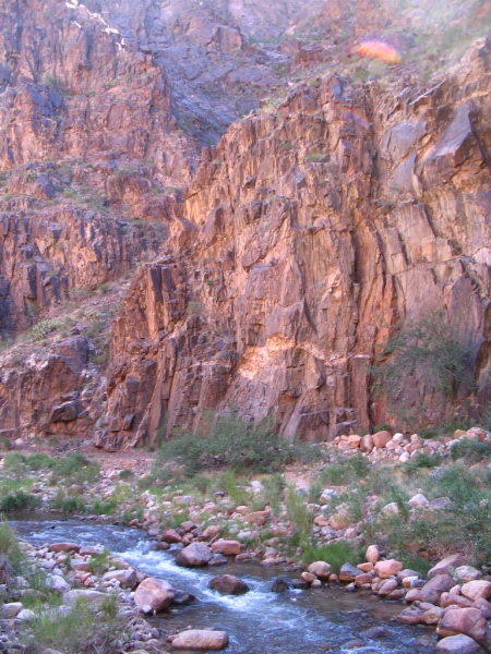
 It got dark fairly quickly as we descended into narrow sections of the canyon, and finally saw the river. The river is not a force one would expect. Rather, it resembles a large stream more than a one-time torrent that carved out the canyon in the first place. The one-mile stretch from when one sees the river down to the tunnel is very steep and extremely strenuous. I already had some pain and we slowed down as the light faded. Finally, we had to use headlamps and flashlights, and hike the last 45 minutes in gradually increasing darkness. By the time we got down to the river, it was pitch-dark, and very hot. The temperature gradually increases as one descends into the canyon. We had started in pleasant temperatures near the top, even when the sun was out. The temperature at the bottom was at least 10-15 C higher than at the rim.
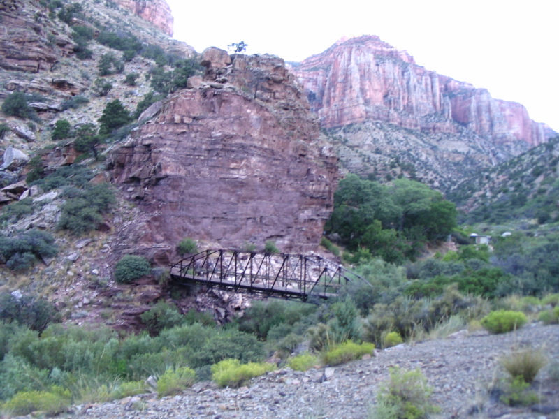
We stumbled our way through the very short tunnel, crossed a bridge, and came up on the sign that proclaimed "Bright Angel Campground". After a fairly long restroom break - cooling ourselves down with water and wiping the sweat off the face - we tried to follow the directions to the campground. Not having done our homework, we set off on the wrong path - on the Bright Angel trail that leads back to the rim! After a few minutes of this confusion, we backtracked, saw the trail map with a little more attention and finally found the path to the campground.
In the absolute darkness that had fallen by now, we proceeded to set up the tent, ate the pre-packed (thanks to the fabulously detailed pre-planning by Kiran) "bataataa bhaaji", and tried to get some sleep. It was still fairly warm, and I was too tired to notice. I managed to get a few hours of sleep.
The plan was to get up at dawn and start early the next day. We had planned to hike out of the canyon the next day - the entire remaining stretch of 13-14 miles of the North Kaibab trail. It was not to be - on the second day, almost nothing went to plan. Looking back, it was awesome though.
Day 2: Crossing the river - Bright Angel to Cottonwood campground
As planned, we did get up at dawn - except that our idea of dawn was "when light enters the tent". This was around 6.15 am, after a night of intermittent sleep for me, and almost none for Kiran. The heat affected him much more than me. It took us much longer than anticipated to disassemble the tent, eat and drink, repack the backpacks, and get ready to resume the hike.
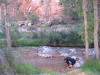
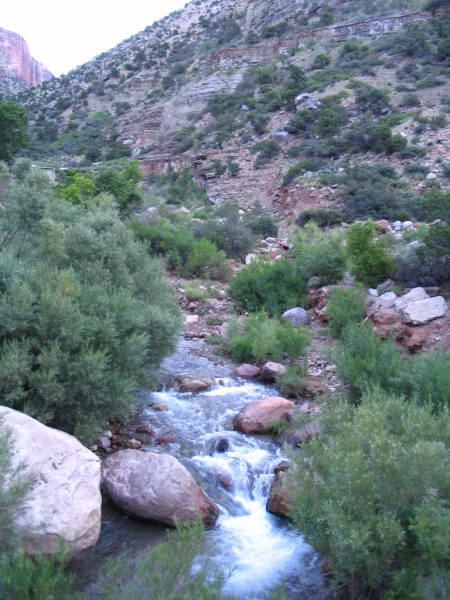
 I took some pictures of the campsite and the surrounding views. Bright Angel campground has a number of campsites set along the Bright Angel creek. The site is pretty, and unique - wide enough to host the campgrounds and the Phantom Ranch, and yet, at the bottom of the Canyon, surrounded by tall peaks on all sides. Thanks to the year-round water, there is some greenery, mostly shrubs, in this part.
Around 8.30 am, we walked the short distance to the Phantom Ranch. Phantom Ranch is a set of small cabin-like structures, some lodgings for overnight stays, a restaurant that offers steak dinners and beer, and a small store. We bought and wrote some postcards from here. The postcards have a "mailed by mule" stamp on them, and are carried out of the canyon by mules.
An hour later, we started off on the North Kaibab trail. It was already very hot and uncomfortable, even after soaking down completely. The trail in this part winds near the bottom of the valley, with several stretches of slight climbs and descents. There are no wide open spaces or the spectacular views. Rather, this is a stretch where the flowing water in the Bright Angel creek separates peaks rising up on either side. Some larger peaks are visible in the distance. The red peaks surrounding us on the hike were in a sharp contrast with the cloudless, clear blue sky above, and the pleasant green of shrubs and small plants and grass, all around the flowing water.
 Soon, we entered into the part of the canyon known as "The Box". This is where the valley gets really narrow - the vertical dominating horizontal dimensions. By the time we hit the box, it was well into the day, around 11.30 am or so. It got very hot. The entire stretch of the hike through the box, and afterwards had very little shade. (We learned later that it was about 107 F in the shade - 125 F or so in the sun). Having waved and chatted with several people during the couple hours before this, we didn't encounter any other hikers on this stretch. After a while, it seemed as if it was just Kiran and I on the trail, me ahead by about a 100 meters or so, Kiran walking a little slower and clicking some pictures along the way.
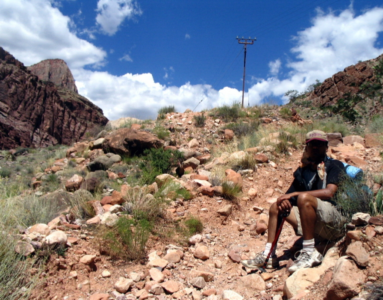
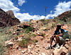
 Even though this stretch didn't have any steep climbs or descents it proved to be the toughest to handle due to the extreme temperature. About two-thirds of the 7.5 miles from the Bright Angel to Cottonwood campground, the heat affected us severely. Kiran suffered cramps, and had to take a long rest in the shade to recover. In this picture, Kiran is sitting on the rock after recovering from cramps. We spent more than half an hour at this location. I even hiked the 100 ft. or so down to the river, just to soak myself down, and fetch some water for Kiran. We were starting to run low on water at this point, even after carrying a full 3.5 litres of water per head.
 We found ourselves out of the box after a little while. The valley got broader again, and we began a steady climb that took us higher and away from the river. The sun was still burning down, and with the cramps and dehydration, it got really difficult. Kiran again got hit the worst, with repeated cramps, and vomiting. Again, we took an hour-long break. We were very close to the Cottonwood campground, probably less than half a mile away, yet had to bide our time till the sun went down.
Our original plan was to hike the 23 miles Rim-to-Rim over two days. Thus, we were attempting to hike 14 miles on the second day. At this point, it seemed a bit of stretch to attempt the remaining 7.5 miles of mostly uphill hike to the North Rim. Slowly, we made our way to the campground, and once there, dropped our bags on the ground in front of the ranger's cabin.
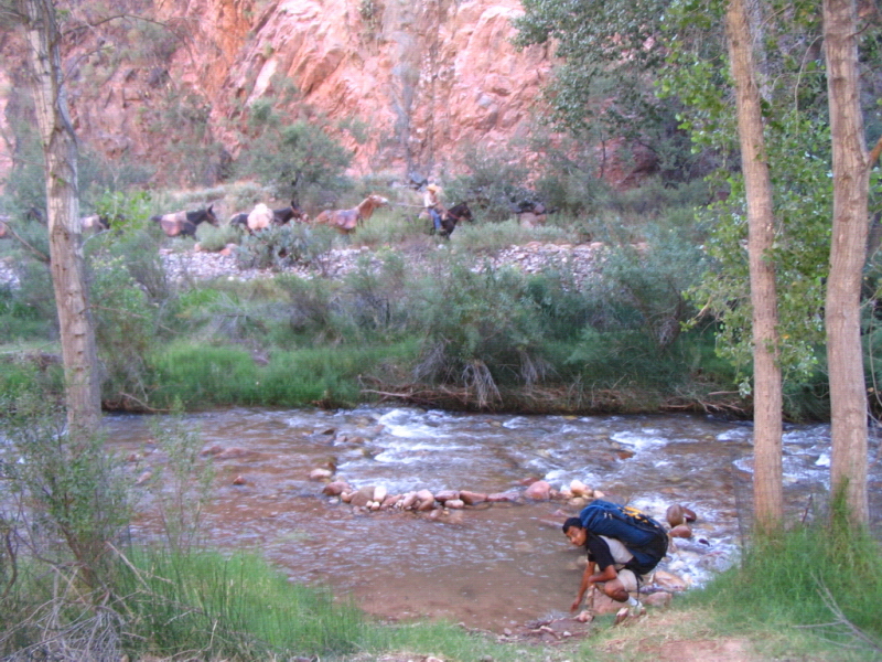
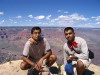
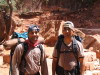
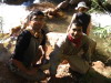 The ranger, Greg Moore, proved to be an extremely nice and helpful man, someone who knew and loved the Grand Canyon. Even after our persistent questioning about attempting to hike to the rim as opposed to staying at the campground that evening, he was restrained and wise in his response. His only advice was "Go down to the river and sit in the water for a while - cool down and then decide what you need to do. We took his word (see picture). Sitting in the water for the next 15 minutes or so was invaluable. Just see the smiles! It helped us cool down and remember the amazing sights we had seen along the way. Right there, we made the decision to stay in the canyon for another day. Both of us realized how much we had enjoyed the hike - even with the heat, dehydration and cramps - and how unique the site we were at was.
The big lesson for us city folk (well, Kiran is no longer a city person - Houghton, MI is as remote as it gets!) was - don't hurry, take your time, and enjoy the slower pace of life in the outdoors. In trying to hurry to the rim, I had almost forgotten why I was out in the canyon in the first place. The canyon is beautiful and forces hikers to walk on its terms. It doesn't give to human will - rather it forces one to play by its rules. It is only when I understood this that I truly began to enjoy the hike. All thoughts of home, and hurry, were out of my mind. I was able to take in the spectacular site and appreciate the canyon anew.
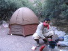

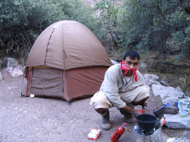
 The rest of the evening was spent setting up the tent, cooking and eating, and taking pictures. The campsite was in a nice location again, though not nearly as beautiful as the Bright Angel campground. Cooking proved to be a fun exercise - lighting the stove, boiling the water, and finally cooking the Top Ramen noodles and the dried lasagna. Ramen noodles have never tasted so good ;).
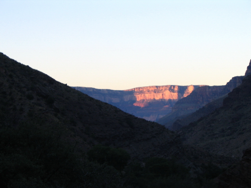
We had learnt our lesson well - sleep early, wake up before sunrise, and begin your hike as early as you can. We also knew the time it took us to set up and wind up camp, and thus, were able to plan for an early start for day three - to leave at 6 in the morning, the alarm was set to 3.45 am. Watching the sun set slowly, the light fading away from the valley, leaving just the peaks with some light, and the gradual onset of darkness, I arranged my sleeping pad. I was fast asleep by the time it got really dark.
Day 3: Climbing out of the Canyon - Cottonwood campground to the North Rim

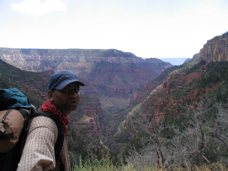
 As planned, we began our hike around 6 in the morning. There was already plenty of light. The temperature was very comfortable, and without the sun burning overhead, this was the most pleasant part of the hike so far. Kiran had recovered well from the previous day's troubles, and the night's sleep seemed to have reenergized him. He set off at a good pace, pausing every few hundred meters. I followed closely behind, clicking pictures along the way. We quickly covered a lot of distance, on a slight ascent.
 Again, I realized that the morning and evening light, when the sun shines on the canyon from an angle, rather than from straight above, brings out the varied colors of the rock formations. From brilliant bright red, to the muted brown-yellows, and the green-tinged (partially due to the shrub covering them), the rocky walls of the canyon all look much more appealing in the early morning and late evening hours. I took a whole lot of pictures over this stretch, keeping pace with Kiran on our uphill hike.

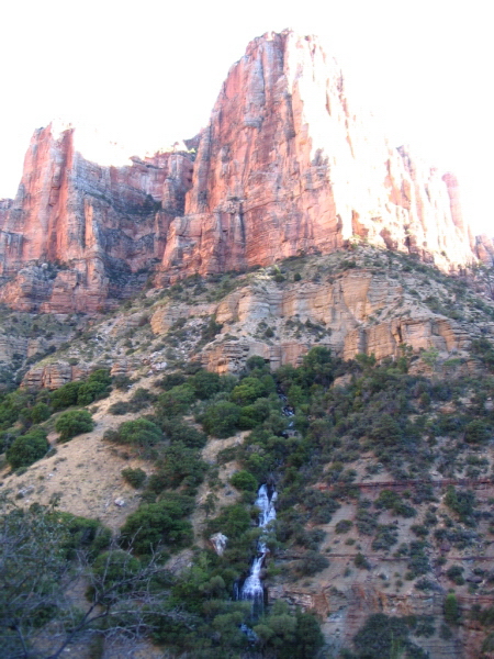
 There are several water sources along the way, which makes this part of the trail a fairly easy climb. We saw some springs on the way, and soon had made our way out of the bottom of the valley, closer to the previously distant walls of the North Rim. The hike got much more difficult, the elevation on the trail very steep, as we hit the Supai rocks. The trail was a brilliant red, the sun had now started to burn down upon us, and the entire valley was bathed in brilliant light, underneath the clear blue sky that was free of any clouds.
 This was a fairly arduous stretch, and we took frequent breaks along the way. Passing a couple of bridges, and the needle, we neared the end of the Supai rocks, about 5-6 miles from the Cottonwood campground. During this stretch, there was no shade on the trail. The steep hike slowed us down significantly. By this time, I had become very familiar with my own shadow.
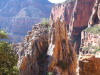
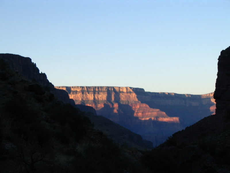
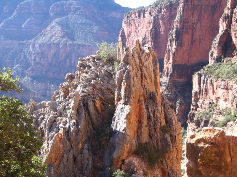
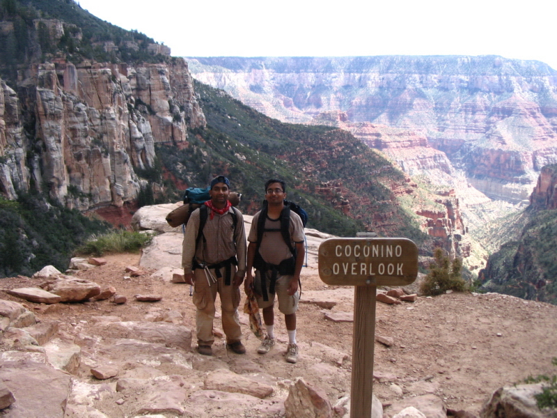
 We crossed the Supai tunnel, which signified the end of the strenuous part of the hike. We beat the heat by pouring water all over, having covered most of the distance before noon. This was a fairly long break, as this was our last point with a grand view of the valley, before we hiked the last couple miles, up into the increasingly dense pine trees of the North Rim. We knew that we had finished the toughest part of the hike, with plenty to spare. The view from this point was fabulous - the needle visible at a significant distance and depth inside the valley, the steep trail seen in parts, and the greenery near the river a very distant sight. This contrasted with the South Rim - from the South Rim, the view one gets is like a wide-screen film - vast landscape of the canyon on either side; from the North Rim, the depth of the valley, and the many miles of trail into the canyon are seen clearly, a narrower perspective, reaching its convergence point in the heart of the canyon.


 We met a lot of other hikers along the way - some hiking all the way to the Cottonwood campground, others on a day trip descending some distance into the valley to get a closer look, and a feel for Grand Canyon hiking. By now, we were the ones answering questions, and getting the admiring looks from people. The unshaven look, the 40+ pounds on the back, and a strained, but happy expression on our faces had many hikers asking about our trip. We were glad to oblige, and share stories with many others, often several years our senior. Some told us of their rim-to-rim hike, others of their planned trip, and yet others of other wonderful sites they had been to. That's another thing I noticed on this trip - it was easy to talk to strangers and swap stories, probably because all of us were at a place unlike any other, and shared a unique experience.
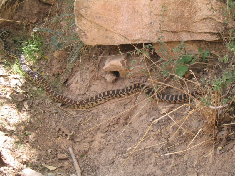
 The rest of the hike out of the canyon was at a leisurely pace. We walked with confident, relaxed strides, savoring the last couple of miles of our memorable hike. We made way for the mule rides going down the trail, encountered a king snake and took in the spectacular views that appeared as the trail switched back and forth along the mountain. The 2 miles took us almost two hours, and yet, we didn't feel much strain. The temperature near the North Rim was very pleasant, even between noon and two o'clock.

 We reached the North Rim a little after two o'clock. Just like that, we had finished the hike! All that was left now was to find a campground, set up the tent, and take in the magnificent sunset over the Grand Canyon. We got back into normal life mode, after two and a half exciting, enjoyable, and exhausting days. Showers, a cooked meal, and other amenities of regular life seemed luxurious. The campsite we got was right at the rim. Settling down, we dwelled on a great trip, and started to plot our next trip.
Day 4: Sunrise at North Rim and drive back to South Rim

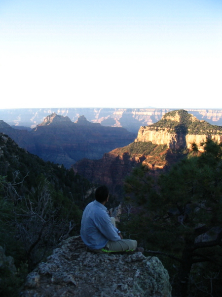
Fully refreshed after a good night's sleep, I woke up just before sunrise the next day. Around dawn, only the peaks appear bright. The light slowly moves down the mountains into the valley. The morning sunlight makes the colors of the various layers of rock come alive. Kiran and I took turns taking pictures, and watching the sunrise. We then caught the morning shuttle (bright and early at 7.10 am) back to the south rim.
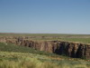
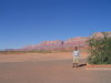 The entire stretch of about 210 miles between the north and south rim is non-private land - the Grand Canyon national park near the rim access points, the national forest a few miles outside of the park area, and Bureau of Land Management owned land the rest of the way. Pines dominate the park and forest areas, giving way to wide open flat terrain in other parts. The Navajo Indian reservation is also a big part of this area. The green pine-covered hills change to the dominant red Arizona landscape a few miles away from the national forest. Under the blue, cloudless sky, and the bright sun, the wide open space was very impressive. No man-made structure could be seen for most of the drive! For me, the open space visible as far as eye could see was just as magnificent a site as the deep and wide canyon. Just see the pictures below.
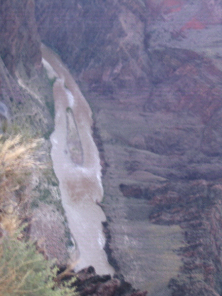
 Back at the south rim, we got one last view of the canyon from Desert View, another viewing point we hadn't been to. This is the only point at the south rim from where the river can be seen. This bonus was thanks to Rita, our shuttle bus driver. She told us many stories of her adventures (including a eleven-hour rim-to-rim hike) and of the the geology and history of the Grand Canyon area.
One last sighting of the Grand Canyon done, we quickly got back to city mode. We had to get back to Las Vegas in time to catch our flights home. It had been a very exhausting, but highly rewarding four days. This was certainly the most enjoyable trip I have had in a long time. I promised myself that I'd go back to the mountains very soon.
The Andes, anyone?